Understanding Weather and Tides

Any seaman worth their salt should set sail equipped with a good understanding of weather and tide patterns. It’s no use cursing the weather forecaster when the sky and waves turn nasty without warning.
The Importance of Self-Sufficiency
Although modern technology has enabled forecasters to offer valuable data about marine weather patterns, it shouldn’t be relied on as the only source of information. Forecasts can sometimes differ, the progress of weather systems can vary and what’s more the technology used to receive weather data can even go wrong.Understanding the underlying patterns that drive the weather will enable you to understand what is happening when forecasts prove to be inaccurate, and help stop you from being caught out in future.
Learning Marine Meteorology
The importance marine meteorology as a core seamanship skill is highlighted by in appearance on the syllabus for the RYA’s (Royal Yachting Association) ‘Day Skipper’ and ‘Yachtmaster’ courses. Non-RYA courses are also available specialising in marine meteorology.In addition to teaching you how marine weather works, these courses will help you to take advantage of the various sources of weather information available. The idea is that instead of relying on the predictions of others, you should be able to utilise both official and personally acquired data to become your own marine forecaster.
To gather their own weather data, skippers can use such references points as the Beaufort Scale, Met maps, and the humble barometer.
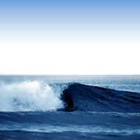
The Beaufort Scale
The famous Beaufort Scale was originally conceived as a system for estimating wind power without the need for specialised equipment, and was first introduced in 1806 by Admiral Sir Francis Beaufort of the British Navy. Despite its age, it is still a valuable tool today, particularly for recreational sailors who don’t have specialist onboard wind measuring facilities.The simple principle of the scale is that descriptions and photos of the sea are used to gauge the wind speed across a range of thirteen steps, from the total calm of force 0 up to the wild hurricanes of force 12.
Metmaps and Marinecall
To create personal synoptic charts – a weather diagram showing barometric pressure isobars, warm, cold and occluded fronts – Met maps are available from the RYA and Royal Meteorological Society. These are blank maps and tables used for recording the information obtained from the shipping forecast. They are useful to have aboard on a journey at all times, and are easy to use because the order in which the fields are arranged on the Met map directly correlates to the order that the information is reported on the radio broadcast.For forecasts for longer trips, the information can be texted to a mobile on route with the aid of the Met Office’s Marinecall service.
The Handy Barometer
As weather forecasts are fairly broad in scope and don’t take in account the fact that small areas can experience conflicting weather patterns, it is always useful to be able to monitor weather in the immediate area.A useful tool for this is the air pressure gauge known as a barometer. For example, as a general rule any rapid change between high and low pressure can mean either strong winds or bad weather.
Weather Forecasts
Personal weather predications should always be carried out in conjunction with official forecasts.Before embarking on a trip out on the water, you should consult at least two separate weather forecasts. These should be obtained both 24 hours ahead of a planned trip and then once again before leaving. The closer the forecast is issued to the period it relates to then the more accurate it will be.
Even in our advanced technological age, we are still unable to predict the weather beyond three days with any degree of certainty. For this reason the last two days of any five day forecast should be treated with great caution.
Understanding Tides
Tides create currents and raise and lower the depth of the water. The tidal range is usually measured as the difference in height between the average level of high tide and low tide.Tidal ranges can vary from as little as a foot from high to low water to, in exceptional cases, over 50 feet. Even minimal tides can have a significant effect. For example, in shallow areas a tidal fall of a few inches can reveal hundreds of acres of bottom and prove the critical difference in whether a boat is too big to enter particular waters.